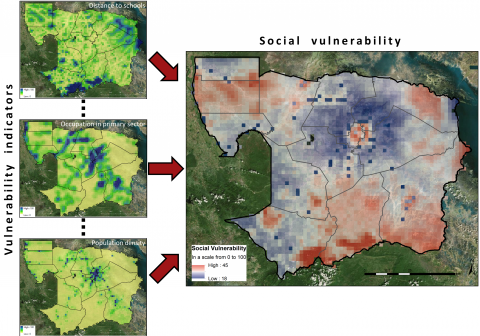
Required processing:
Analysis and treatment of missing data and outliers, data transformation (absolute to relative values), resampling (2 km grids);
Multicollinearity analysis, normalization/standardization, expert weighting (AHP), weighted aggregation, sensitivity analysis, visualization.
Data requirements:
Socio economic and demographic data, infrastructure data, weight definition with the users
Validation process:
Expert feedback has been gathered during a stakeholder workshop in Battambang, Cambodia.
Spatially explicit information on social vulnerability of people living in mine affected regions was considered of high relevance for mine action by the local experts.
Map of the social vulnerability of the population to be negatively affected by landmines/UXOs.
Why using remote sensors?:
The vulnerability analysis could support the priority settings.
The criteria included in the vulnerability analysis are defined and weighted with the users.
Technical contact:

