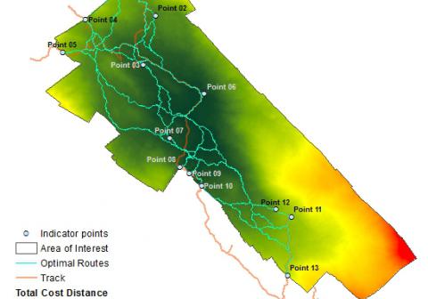
Required processing:
Correction and smoothing of DEM, wathershed calculation, compute Cost Surface Raster with map algebra techniques, launch least-cost path script (CPU time consuming)
Data requirements:
Digital Elevation Model (DEM) and indicator points.
Most effective routes across a given area used to reconstruct former battleground theatres.
Why using remote sensors?:
A trafficability analysis measures the cost of a person/vehicle to pass through a specified terrain in terms of time and effort, and could determine the most probable accessible route among some given locations.
Technical contact:

