Wiki FP7-Tiramisu


Published on Wiki FP7-Tiramisu (http://geospatial.fp7-tiramisu.eu)

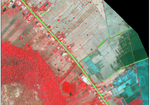
Roads and broad tracks

General info
Category: 
Road network
Platforms: 
Very High spatial resolution satellite
Scale: 
1/25 000 to 1/1 500
Spatial resolution: 
10 to 0.5m
Sensor reference: 
QuickBird-2
WorldView-1
IKONOS-2
Pleaides1A
Pleiades1B

Technical details

Required processing: 
Orthorectification and mosaicking of the satellite images, object-based image analysis (OBIA), vectorisation. The output of a dedicated line detector can be added into the object-based image analysis.
Data requirements: 
Very-high resolution satellite imagery (e.g. Pleiades, QuickBird, WoldView-2, IKONOS, etc.)..

Description

Semi-automatically detected roads and broad tracks (georeferenced polygons).

Why using remote sensors?: 

Producing an up-to-date map of the roads and of the broad tracks in an SHA can support the preparation of field surveys.
If tracks were built during the conflict (e.g. for logistics), detecting them can help understand the conflict landscape.

Contacts

Technical contact: 
PLUS
[email protected]
Source URL (modified on 10/13/2015 - 02:23): http://geospatial.fp7-tiramisu.eu/products/roads-and-broad-tracks