Wiki FP7-Tiramisu


Published on Wiki FP7-Tiramisu (http://geospatial.fp7-tiramisu.eu)

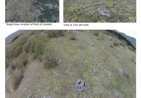
Views of infantry and artillery fortifications

General info
Category: 
Detection of specific objects
Platforms: 
Multi-rotor RPAS
Scale: 
Area of interest
Spatial resolution: 
0.024 to 0.012 m

Description

Obliques images at various pre-set altitudes (ex 15 and 25 m) and vertical panoramic images (fish-eye type)

Why using remote sensors?: 

RPAS allows to flight over specific points of interest that might be identified from lower resolution image or from military records, enabling the recognition of important objects such as shelters.

Contacts

Technical contact: 
Royal Military Academy
[email protected]
Source URL (modified on 09/22/2015 - 14:43): http://geospatial.fp7-tiramisu.eu/products/views-infantry-and-artillery-fortifications