Wiki FP7-Tiramisu


Published on Wiki FP7-Tiramisu (http://geospatial.fp7-tiramisu.eu)

Forest edges and clearings

General info
Category: 
Detection of specific objects
Platforms: 
High spatial resolution satellite
Scale: 
1/100 000 to 1/25 000
Spatial resolution: 
30 to 10m
Sensor reference: 
LANDSAT1-MSS
LANDSAT2-MSS
LANDSAT3-MSS
LANDSAT4-MSS
TERRA-ASTER
SPOT1-HRV

Technical details

Required processing: 
Pre-processing: orthorectification and georeferencing, Pixel-based classification of the forest, Vectorisation of the edges.
Data requirements: 
Archived High spatial resolution satellite images (e.g. LANDSAT MSS or TM, TERRA-ASTER, SPOT)

Description

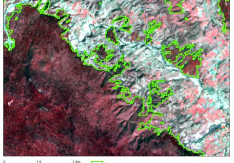
Georeferenced polygons of forest edges and clearings.

Why using remote sensors?: 

In some conflicts, the forests are used to hide the troops making temporary clearings and/or modifying their boundaries.
To improve the SHA delineation, the forest edges at the time of the conflict can be mapped from free archived images covering large areas since the 70's.

Contacts

Technical contact: 
IGEAT
[email protected]
Operational contact: 
NOVELTIS
[email protected]
Source URL (modified on 10/13/2015 - 01:50): http://geospatial.fp7-tiramisu.eu/products/forest-edges-and-clearings