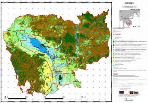
Required processing:
Orthorectification and georeferencing, legend definition with the users according to their needs and the detection possibilities, object-based classification
Data requirements:
High resolution satellite imagery such as Landsat (LANDSAT1-MSS, LANDSAT2-MSS, LANDSAT3-MSS, etc.) and SPOT (SPOT1-HRV, SPOT2-HRV, SPOT3-HRV, etc.).
Validation process:
A point-based accuracy assessment has been conducted. It resulted in an overall classification accuracy of 92%.
Land use/land cover classification in 6 classes (water, Bare soil and built-up, Cropland, Vegetation dense, vegetation medium, vegetation sparse) based on Landsat imagery using object-based image analysis (OBIA).
Why using remote sensors?:
Mapping the land cover and the land use may be usefull during the Non-Technical Survey and the Technical Survey. Information on the LU/LC cann support the planning and management of the activities during the different demining phases.
Technical contact:
Operational contact:

