Wiki FP7-Tiramisu


Published on Wiki FP7-Tiramisu (http://geospatial.fp7-tiramisu.eu)

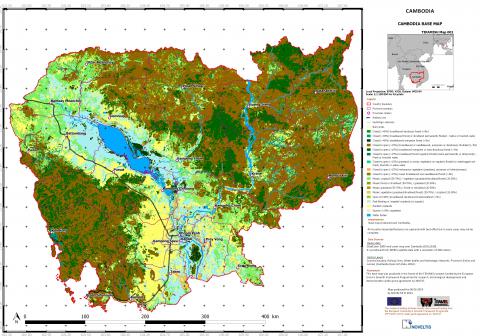
General Land Cover - Land Use map

General info
Category: 
Land Cover - Land Use maps
Platforms: 
Medium resolution Satellite
Scale: 
1/1 000 000 to 1/100 000
Spatial resolution: 
>30 m

Technical details

Required processing: 
Georeferencing, Vectorisation, Quality check and anomalies correction of input data (if any)
Data requirements: 

GlobCover (ESA,2010), Administrative data, networks layers (roads, trains, etc.), hydrologic networks, DEM, etc.

Description

General land use - land cover map in 19 categories.

Why using remote sensors?: 

This general land use - land cover map is useful to support for the planning and the management of the activities during the different demining phases.

Contacts

Technical contact: 
NOVELTIS
[email protected]
[email protected]
Operational contact: 
NOVELTIS
[email protected]
[email protected]
Source URL (modified on 10/13/2015 - 01:04): http://geospatial.fp7-tiramisu.eu/products/general-land-cover-land-use-map