Wiki FP7-Tiramisu


Published on Wiki FP7-Tiramisu (http://geospatial.fp7-tiramisu.eu)

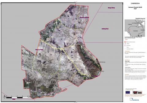
Satellite base map (very high resolution)

General info
Category: 
Base map
Platforms: 
Very High spatial resolution satellite
Scale: 
1/25 000 to 1/1 500
Spatial resolution: 
10 to 0.5m
Sensor reference: 
LANDSAT8-OLI

Technical details

Required processing: 
Orthorectification and georeferencing, Vectorisation, Quality check and correction of anomalies in input data (if any).
Data requirements: 
High satellite imagery (such as Landsat 8), Administrative data, networks layers (roads, trains, etc.), stream networks, contour lines, etc.

Description

Georeferenced Very-High spatial resolution images.

Contacts

Technical contact: 
NOVELTIS
[email protected]
[email protected]
Operational contact: 
NOVELTIS
[email protected]
[email protected]
Source URL (modified on 10/13/2015 - 01:52): http://geospatial.fp7-tiramisu.eu/products/satellite-base-map-very-high-resolution